Supply chain innovation: drone corridor unlocks pilotless future
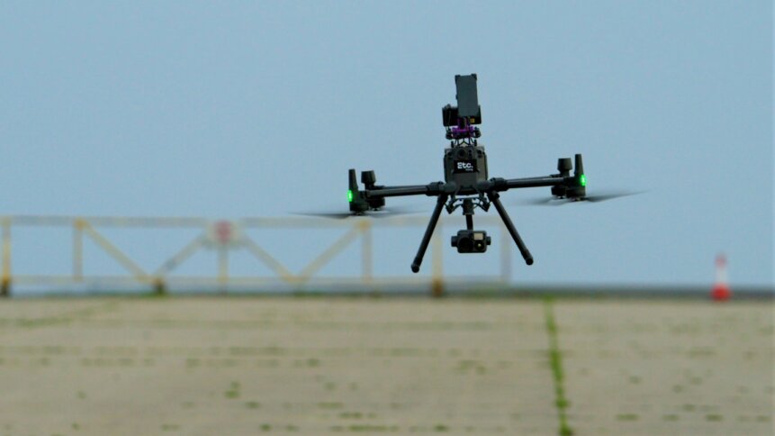
Path finder: BT Group’s incubation hub, Etc., has entered into a £5 million agreement with Altitude Angel, an aviation technology provider, to mobilize UK airspace for uncrewed aerial vehicles, supporting drone corridor ambitions. Image credit: BT Group.
|
Getting your Trinity Audio player ready...
|
If you’re a fan of flight tracking websites such as flightradar24.com, planefinder.net, and other apps showing air traffic, then you’ll be familiar with the concept of highways in the sky. Monitored by air traffic controllers, planes keep to designated flight paths or air tracks. Point-to-point air transport has tremendous supply chain advantages, primarily in getting goods to customers in the shortest possible time. And delivery options could soon include uncrewed aerial vehicles (UAVs) thanks to commercial drone corridor plans.
Project Skyway
One of the most ambitious efforts is the UK’s ‘Skyway’ project, which leverages mobile networks combined with technical expertise to establish a so-called ‘drone superhighway’. Once complete, the drone corridor scheme will span 165 miles (265 km) of connected airspace, linking major cities such as Reading, Oxford, Milton Keynes, Cambridge, Coventry, and Rugby.
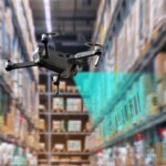
E-commerce delivery, promoted by tech giants such as Amazon, has grabbed many of the headlines in the use of UAVs to boost supply chain innovation. But there’s much more to the use of drones in transportation than simply extending retail delivery options.
“You think about getting blood [products] from hospital to hospital; you think about donors; you think about farming – every single industry will be impacted by drones,” comments Tom Guy, Managing Director of Etc. – the start up and incubation arm of BT, which sits within the group’s Digital unit and is a partner in the UK’s ‘Skyway’ project. “We think drones will revolutionize the way we live and work, and even save lives.”
Drone corridor definition
As Altitude Angel (another member of the ‘Skyway’ team) explains:
- A drone corridor allows any UAV manufacturer to connect a drone’s guidance and communication system to a virtual superhighway in the sky.
- The system, which features a ground-based network of high-resolution sensors, takes care of guiding drones safely through air corridors.
- Notably, setting boundaries on the location of UAVs lessens requirements on having human pilots, which currently puts a barrier on scaling up transportation using drones.
The goal of the partnership is to open up the skies in a safe manner to solve customer and business problems. Altitude Angel already offers a drone safety map that spans more than 152 countries and presents aeronautical and ground hazards information to drone pilots, aviators, and emergency services. And, in January 2023, Altitude Angel announced that it had entered into a £5 million agreement with BT Group. The deal will accelerate Altitude Angel’s roll-out of technology – dubbed ‘ARROW’ – capable of detecting and identifying drones. The system is designed to enable drones to share the airspace with crewed aviation safely and securely.
Back in 2018 – at an event named ‘Operation Zenith’, held at Manchester airport in the UK – experts demonstrated how air traffic management and unmanned traffic management could be integrated in controlled airspace. Building on this, the team flew more than 140 drone flights in the summer of 2022 along an extended section of the UK’s first drone corridor, south of Reading. Flight partners included Skyfarer, Herotech8, Searchbound Rescuer, Animal Dynamics, Texo Drone, Thames Valley Police, and the Altitude Angel flight team.
Global effort
The UK is not alone in building systems that will allow drones and crewed aircraft to co-exist. In the US, DronePort Network announced in December 2022 that it had formed a partnership with Osage to manage an aviation facility in Tulsa dubbed ‘Skyway 36’. Plans include a 114-nautical-mile flight corridor, suitable for drones. And, according to Craig Mahaney, CEO of the DronePort Network, “The vision for Skyway36 is a commercial test bed for the integration of autonomous flight technology into our everyday lives.”

Well-managed drone superhighways pave the way for supply chain innovation, allowing businesses to get products to customers through new channels. Automation has the potential to ease dependence on already congested road networks, and – as BT’s Tom Guy touched on earlier in this article – transform a wide range of sectors, from agriculture to healthcare.
As well as queue-jumping road traffic, drones are well-suited to servicing remote locations, and areas that have become hard to access on the ground. In 2017, the Government of Malawi and UNICEF launched an air corridor to test the use of drones for humanitarian purposes. Previously, UNICEF had used drones as part of a national response to flooding in the area. And having a drone corridor expands the services that can be enabled.
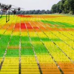
Drones can gather ariel images – for example, to help monitor flooding or damage from earthquakes and other disasters. UAVs could also be used to extend Wi-Fi or cellphone signals, to bring internet connectivity to schools and other facilities. And, as with the industrial supply chain examples, drones make it straightforward to transport essential supplies such as medical items.
The case for uncrewed aerial vehicles is a strong one, supported by drone superhighways and a safe and regulated shared airspace that allows all stakeholders to prosper.

5 March 2024