Data match made in heaven: citizens and satellites
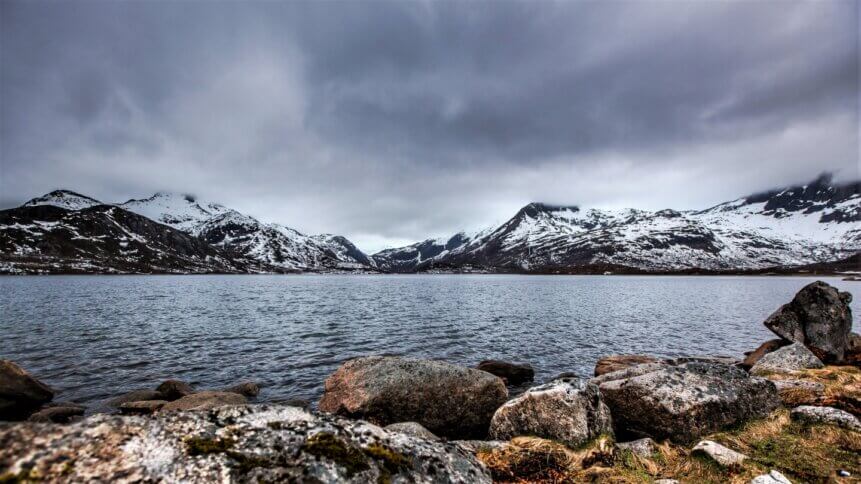
Rain or snow, or both? Satellites struggle to tell the difference. Image credit: Shutterstock.
|
Getting your Trinity Audio player ready...
|
CubeSats, picosats, smallsats, NewSpace, alt.space – these are all keywords that point to the rise of disruptive technology that’s changing the business of space. Entrepreneurial firms are finding opportunities to launch much more affordable satellite missions and commercialize their data. This wealth of new information is improving crop monitoring, encouraging the eco-friendlier design of buildings, and much more besides. But the view from space doesn’t always tell the full story, which is where scientific crowdsourcing of satellite data can help.
One example is ‘Mountain rain or snow’ – a project in the US that has just been awarded an additional three years of funding by NASA’s Citizen Science for Earth Systems Program. The initiative was initially focused on Tahoe, but has expanded to other mountainous US regions and addresses one of the shortcomings of satellite imaging. “Satellite technologies often struggle to differentiate snow from rain near the freezing point in mountainous regions, with impacts on flood predictions, avalanche forecasting, snowpack water storage, and road safety,” writes the project’s team.
Where scientific crowdsourcing of satellite data can help
To get involved, volunteers living in one of the mountainous areas of interest first register for storm alerts, providing a keyword that puts their location on the map. For example, ‘WINTER’ refers to the Sierra Nevada region, and ‘CORainSnow’ corresponds to the Rocky Mountains of Colorado – there are currently eight areas in total. Then, once signed up, citizen scientists are directed to a web app. Here they contribute by ticking one of three boxes – whenever there is a storm – to indicate whether conditions are rainy, snowy, or a combination of the two (mixed precipitation).

Leading the project is US science, technology, and engineering firm Lynker. The company has a keen interest in maximizing the accuracy of environmental data as it offers services to help clients better understand risk from natural hazards. Increasingly, firms are realizing that they need to evaluate their exposure –which includes across supply chains – to the possibility of floods, wildfire, sea-level rise, heat waves, droughts, hurricanes, and other phenomena associated with global warming.
The citizen science initiative has already gathered useful information, which can be used to fine-tune models fed with satellite data. Observations submitted by more than 1,100 people who signed up last winter showed that in the Sierra Nevada region, rain transitions to snow at around 36 degF (water freezes at 32 degF). But the data indicates that the snow-rain threshold is closer to 40 degF in the Rockies, which compares with 33 degF in the Northeast. And thanks to the community of observers, the project’s dataset is growing – highlighting where scientific crowdsourcing of satellite data can help.
“These [results] will ultimately help to improve the predictive technologies that satellites use,” said Meghan Collins, an associate research scientist based at Desert Research Institute (DRI) – another partner in the project. Completing the group are experts in hydroclimatology, hydrology, and geospatial analysis, who are based at the University of Nevada in Reno, US. Insight generated by the project will feed into better decision-making as the world comes to terms with much more dramatic weather patterns.
‘Mountain rain or snow’ isn’t the only project to recognize where scientific crowdsourcing of satellite data can help to improve information accuracy. In fact, the US has been quick to identify the competitive benefits of incentivizing individuals and organizations to collaborate in innovative ways. And the government built its CitizenScience.gov website specifically for the task of accelerating the use of crowdsourcing and citizen science across the US.
Volunteered geographic information
Case studies note that volunteer participation can improve the accuracy of collected data, reducing the number of errors in activities such as mapping. And better data can lead to better outcomes. As the World Bank Group has pointed out previously, governments rely heavily on geographic data, but there can be gaps in the information that has been collected. For example, there may be locations or time periods that are not represented. And this is where volunteered geographic information (VGI) may prove useful.
In many cases, it can be quicker to ask the public – especially if you have an efficient web app, as is the case for ‘Mountain rain or snow’. This not only speeds up the process, but it can save money. Taxpayer funds can instead be distributed across other projects – enabling government departments to do more with their budgets. Naturally, projects need to have public appeal, and recruiting charismatic organizational champions is another good idea if you want initiatives to succeed.
After major flooding events in the UK in 2015, a local government-led project crowdsourced information from firms to quickly determine which companies were open for business. Satellite data would do well at monitoring the flooding, but as waters receded, the information would provide few details on how quickly firms were able to restore their operations. Being able to rapidly set up mapping applications to gather crowdsourced data was an efficient way of filling the information gap.
As observers note, authorities can soon become overwhelmed in disaster situations. And volunteered geographic information can prove invaluable in focusing efforts and highlighting where help is available.

5 March 2024